MARITIME NAVIGATION JOURNAL · BRIDGE OPERATIONS
Navigating When the Horizon Disappears
How ships maintain situational awareness in fog using radar, electronic navigation systems, careful observation, and coordinated decisions on the bridge.
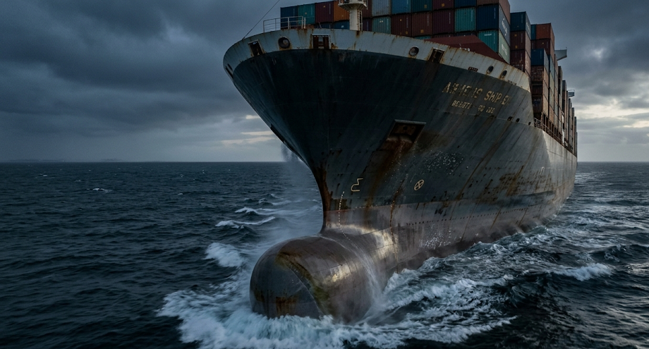
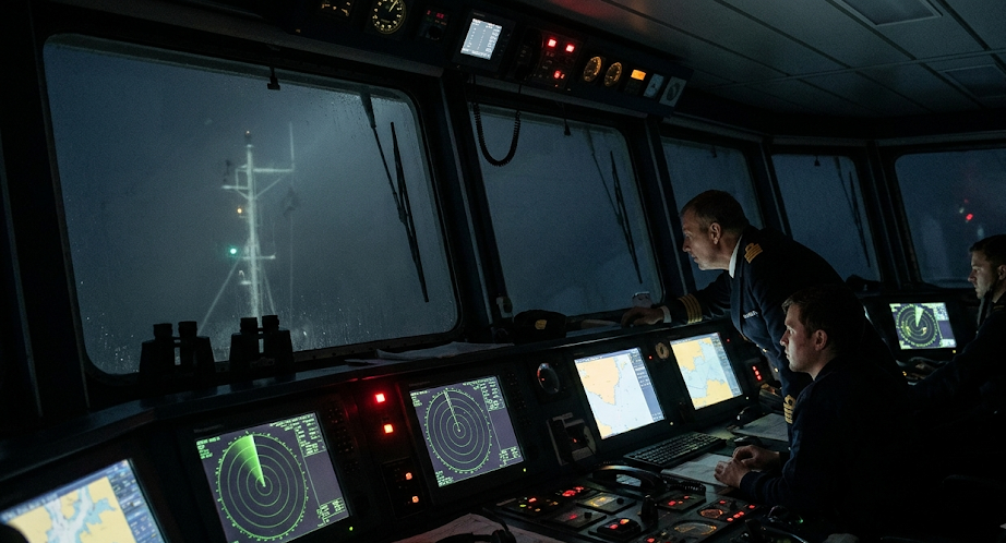
Imagine standing on the bridge of a large cargo ship as thick fog spreads across the sea.
The horizon disappears.
Nearby vessels become difficult to see, and even familiar landmarks may vanish from view.
Yet the ship must remain aware of its surroundings, maintain a safe course, and avoid collisions.
Modern ships use several navigation technologies to help manage these conditions.
Radar detects objects beyond normal visual range. Electronic charts display navigational information. Satellite positioning helps establish the vessel’s location.
However, technology alone does not make navigation safe.
Bridge officers must interpret information, monitor changing conditions, communicate clearly, and follow established collision-prevention rules.
Safe navigation in fog depends on combining electronic information with human judgment, proper lookout, and coordinated bridge teamwork.
Why Fog Makes Navigation Difficult
Fog consists of tiny water droplets suspended near the surface.
These droplets scatter light and reduce visibility.
At sea, fog can form when moist air cools sufficiently for water vapor to condense.
One common example is advection fog, which can develop when relatively warm, moist air moves over colder water.
Other atmospheric conditions can also produce fog.
For a ship’s crew, the immediate problem is reduced visual information.
Officers may be unable to see another vessel until it is dangerously close.
Buoys, shorelines, fishing boats, and navigation marks may also be difficult to identify visually.
Sound can provide additional information, but its direction and distance can be difficult to judge accurately.
These limitations make systematic observation and appropriate use of navigation equipment especially important.
Radar: Detecting Objects Beyond Visual Range
Marine radar is one of the most important tools available to a ship navigating in restricted visibility.
Radar works by transmitting radio-frequency energy and receiving echoes reflected from objects.
The system measures the time between transmission and reception to estimate distance.
It also determines the direction of detected targets relative to the ship.
On a radar display, nearby vessels, landmasses, and some navigation marks may appear as echoes.
This allows bridge officers to monitor surrounding objects even when those objects cannot be seen directly.
Radar is particularly useful for identifying traffic, measuring ranges, and assessing how targets move relative to the vessel.
However, radar is not a perfect picture of reality.
Small objects may produce weak echoes.
Heavy rain, sea clutter, interference, equipment settings, and the radar characteristics of a target can affect detection.
Operators must understand these limitations and avoid treating every radar indication as completely reliable.
RADAR WATCH / WHAT THE DISPLAY HELPS REVEAL
The direction of a detected object relative to the ship or a selected reference.
The estimated distance between the vessel and the radar target.
How another vessel’s position changes compared with the observing ship.
How Radar Helps Identify Collision Risks
Detecting another vessel is only the first step.
The bridge team must determine whether the vessel presents a collision risk.
A radar target may be several miles away but still require close monitoring.
Officers examine changes in range and bearing over time.
If another vessel remains on a nearly constant bearing while its range decreases, that can indicate a possible collision risk.
However, radar observations must be interpreted carefully, particularly when targets maneuver or measurements are uncertain.
Many ships use automatic radar plotting aids, commonly called ARPA.
ARPA can track selected targets and estimate their motion.
Two important calculations are closest point of approach and time to closest point of approach.
Closest Point of Approach (CPA)
CPA is the predicted minimum distance between two vessels if their current motions continue.
A small CPA may indicate a close encounter.
However, the significance of a particular CPA depends on the circumstances, including vessel size, traffic density, visibility, and maneuvering characteristics.
Time to Closest Point of Approach (TCPA)
TCPA estimates how long it will take to reach the predicted closest point.
A short TCPA may mean that a developing situation requires prompt assessment.
These values are predictions, not guarantees.
If either vessel changes course or speed, the calculated CPA and TCPA can change.
Officers therefore continue monitoring targets instead of relying on a single reading.
Electronic Charts: Understanding Where the Ship Is
Radar primarily helps detect surrounding objects and monitor their movement.
Electronic charts serve a different purpose.
They help navigators understand the vessel’s position in relation to charted geographic and navigational features.
Many commercial ships use an Electronic Chart Display and Information System, or ECDIS.
ECDIS displays official electronic navigational chart information when configured and supplied appropriately.
Depending on the system and installation, it can also show vessel position, planned routes, safety information, and selected sensor data.
Electronic charts may include coastlines, depth contours, charted hazards, navigation aids, and designated traffic areas.
This information is particularly valuable when fog hides landmarks that would otherwise support visual navigation.
However, an electronic chart does not independently verify every object around the vessel.
Uncharted obstacles, temporary hazards, and moving vessels may require other sources of information.
Chart accuracy, survey quality, scale, and updates also matter.
Bridge officers must use the appropriate chart information and verify the vessel’s position through suitable methods.
| Navigation System | Main Purpose | Important Limitation |
|---|---|---|
| Marine Radar | Detects targets and measures range and bearing | Some objects may be difficult to detect |
| ARPA | Estimates tracked-target motion and collision parameters | Predictions depend on tracking quality and current motion |
| ECDIS | Displays electronic chart and route information | Depends on chart data, configuration, and positioning inputs |
| GNSS / GPS | Provides position and other navigation data | Signals can be disrupted or misleading |
| AIS | Exchanges identification and movement information | Not all vessels transmit reliable AIS data |
GPS and Other Positioning Systems
Satellite navigation helps a ship determine its position.
GPS is one example of a Global Navigation Satellite System, or GNSS.
Other satellite constellations can also provide positioning services.
Position information may be supplied to ECDIS and other bridge equipment.
This helps the crew compare the vessel’s location with its planned route and nearby charted hazards.
However, satellite positioning is not immune to errors.
Signal interference, equipment faults, and deliberate interference such as jamming or spoofing can affect navigation data.
For this reason, professional navigators use appropriate cross-checks.
These may include radar ranges and bearings, visual observations when available, and other navigation methods suitable for the circumstances.
Safe navigation requires confidence in the position information—not merely a position symbol displayed on a screen.
AIS: Knowing More About Nearby Vessels
The Automatic Identification System, or AIS, allows equipped vessels to exchange information using radio transmissions.
Depending on the installation and available data, AIS information can include a vessel’s identity, position, course, speed, and other details.
This information can support situational awareness on the bridge.
For example, AIS may help officers identify a vessel detected by radar.
However, AIS must not be treated as a complete traffic picture.
Some vessels may not carry AIS.
Others may have equipment switched off, malfunctioning, or transmitting inaccurate information.
AIS data may also be delayed or inconsistent with radar observations.
Therefore, AIS supports navigation but does not replace radar, lookout, or proper collision-risk assessment.
Why Ships Must Reduce Speed in Fog
Restricted visibility changes how much time a bridge team may have to detect and respond to hazards.
A vessel traveling quickly covers more distance before its crew can assess a developing situation.
Stopping distance can also be substantial, especially for large ships.
International collision-prevention rules require vessels to proceed at a safe speed appropriate to the prevailing circumstances and conditions.
Under the International Regulations for Preventing Collisions at Sea, commonly called COLREGs, safe speed depends on multiple factors.
These include visibility, traffic density, maneuverability, background lighting where relevant, wind, sea conditions, and other navigational circumstances.
For vessels with operational radar, radar characteristics and limitations are also relevant.
Safe speed is not one fixed number for every ship or every fog bank.
It must be evaluated continuously as conditions change.
NAVIGATION SAFETY PRINCIPLE
A Safe Speed Is One That Allows Effective Action to Avoid Collision.
The appropriate speed depends on visibility, traffic, vessel maneuverability, radar limitations, and the surrounding conditions—not simply the ship’s maximum capability.
COLREGs: The Rules Ships Follow in Restricted Visibility
Ships do not navigate through fog using technology alone.
They must also comply with internationally recognized collision-prevention rules.
COLREGs establish requirements for lookout, safe speed, collision-risk assessment, maneuvering, lights, and sound signals.
Rule 19 specifically addresses the conduct of vessels in restricted visibility when they are not in sight of one another.
It requires vessels to proceed at a safe speed adapted to the circumstances.
Power-driven vessels must have their engines ready for immediate maneuver.
The rule also addresses avoiding certain course alterations when a vessel is detected by radar alone, subject to its specific conditions and exceptions.
These requirements are designed to reduce collision risk when visual contact is unavailable.
They require professional judgment and must be interpreted together with the other applicable collision-prevention rules.
For actual navigation, mariners must rely on the official rules, current regulations, vessel procedures, and appropriate training.
Fog Signals: Why Ships Still Use Sound
Sound signals remain an important part of navigation in restricted visibility.
Under COLREGs, vessels use prescribed sound signals according to their type and operating condition.
For example, a power-driven vessel making way through the water is generally required to sound one prolonged blast at intervals of not more than two minutes in or near an area of restricted visibility.
A power-driven vessel underway but stopped and making no way through the water uses a different prescribed signal.
Other vessel categories have their own requirements.
These signals help alert nearby traffic to the presence and general status of a vessel.
However, sound alone cannot reliably establish another ship’s exact position or distance.
Fog signals are therefore an additional safety measure rather than a replacement for radar and proper lookout.
Bridge Teamwork: Why Navigation Is Not a One-Person Job
On a large commercial ship, safe navigation depends on coordinated work among qualified personnel.
The officer of the watch is responsible for maintaining an appropriate navigational watch.
Depending on the situation, the master may be called to the bridge.
Additional personnel may be assigned to lookout, steering, or other duties.
Bridge Resource Management emphasizes communication, shared situational awareness, workload management, and effective use of available resources.
In fog, this becomes especially important because the team may need to monitor multiple targets while also maintaining the ship’s position and route.
Clear communication helps prevent assumptions and misunderstandings.
Officers should be able to raise concerns when observations conflict or a developing situation appears unsafe.
Good bridge teamwork is not simply about having several people present.
It requires clearly understood responsibilities and active coordination.
BRIDGE RESOURCE MANAGEMENT / COORDINATED WATCH
Maintains the navigational watch, evaluates information, and follows applicable procedures.
Maintains observation by sight and hearing and reports relevant information.
Provides command oversight and may take direct control when circumstances require.
Carries out steering orders when manual steering is in use.
Exact staffing and responsibilities depend on vessel type, operating conditions, regulations, and company procedures.
How a Bridge Team Responds When Fog Develops
When visibility deteriorates, the bridge team reassesses the navigational situation.
The response depends on vessel type, traffic, location, weather, and applicable procedures.
Common considerations include reviewing safe speed, maintaining a proper lookout, checking radar settings, monitoring traffic, and ensuring the ship’s position is being verified appropriately.
The team may increase bridge staffing and inform the master according to standing orders.
Required sound signals must be used.
Engines and steering arrangements must be managed in accordance with applicable rules and operational needs.
Radar targets should be monitored continuously rather than checked only occasionally.
Any planned maneuver should account for the surrounding traffic situation and the ship’s maneuvering characteristics.
These activities are part of an ongoing process of observation, assessment, action, and reassessment.
A Practical Example: Two Ships Approaching in Fog
Consider two commercial vessels traveling through an area of dense fog.
Neither vessel can see the other directly.
One ship detects a radar target ahead and begins monitoring its range and bearing.
ARPA may provide estimated target motion and closest-approach information.
The bridge team compares those estimates with radar observations and other available data.
If the situation indicates a developing collision risk, the team must assess the appropriate response under the applicable rules.
That assessment includes the vessel’s speed, maneuverability, surrounding traffic, and the uncertainty of the available information.
After any action, the team continues monitoring to determine whether the situation is developing safely.
This example illustrates why one radar reading is not enough.
Safe navigation depends on continuous assessment rather than a single decision made at the beginning of an encounter.
Why Technology Cannot Replace a Proper Lookout
Modern bridge systems provide extensive information, but each has limitations.
Radar may fail to display a small or poorly reflecting target clearly.
AIS may not show every vessel.
Electronic charts may contain incomplete or outdated information.
Satellite positioning may be disrupted.
Even when the equipment works correctly, operators can misinterpret displays or overlook important details.
A proper lookout by sight and hearing, as well as by all available appropriate means, remains essential under COLREGs.
Human observation and electronic systems complement each other.
The purpose of bridge teamwork is to combine these sources into an accurate understanding of the situation.
Common Challenges in Fog Navigation
Several difficulties can arise when ships operate in restricted visibility.
Radar Clutter
Sea conditions and precipitation can create unwanted echoes that make targets harder to identify.
Uncertain Target Motion
Tracked targets may change course or speed, reducing the usefulness of earlier predictions.
Heavy Traffic
Busy shipping routes can create multiple simultaneous collision-risk assessments.
Equipment Disagreement
Radar, AIS, and positioning systems may show conflicting information that requires careful investigation.
Human Workload
High workload, fatigue, and unclear communication can make decision-making more difficult.
These challenges reinforce the importance of training, established procedures, and effective bridge resource management.
Frequently Asked Questions
How do ships navigate when they cannot see through fog?
They combine radar, electronic charts, satellite positioning, proper lookout, sound signals, and coordinated bridge procedures.
Can radar see through fog?
Marine radar uses radio waves rather than visible light, allowing it to detect many objects despite poor visual visibility. Detection still has limitations.
What is ECDIS?
ECDIS stands for Electronic Chart Display and Information System. It supports navigation by displaying electronic chart information and related data.
What does ARPA mean?
ARPA stands for Automatic Radar Plotting Aid. It helps track radar targets and estimate their motion and closest-approach information.
Why do ships sound horns in fog?
Prescribed sound signals help alert nearby vessels to a ship’s presence and operating condition when visibility is restricted.
Do ships have to slow down in fog?
Ships must proceed at a safe speed appropriate to the circumstances. Reduced visibility is an important factor in determining that speed.
Can ships rely only on GPS?
No. GPS provides positioning information but does not replace collision detection, proper lookout, radar assessment, or independent position verification.
Final Thoughts
Fog removes many of the visual references that mariners normally use to understand their surroundings.
Modern ships respond by combining several navigation methods.
Radar helps detect targets and monitor their movement.
ARPA assists with estimating collision parameters.
Electronic charts help navigators understand the vessel’s position relative to charted features.
Satellite navigation and AIS provide additional information, although neither replaces independent assessment.
COLREGs establish important requirements for lookout, safe speed, sound signals, and conduct in restricted visibility.
Above all, effective bridge teamwork ensures that information is interpreted and acted upon appropriately.
The essential lesson is that safe navigation in fog is not achieved by one instrument.
It comes from combining reliable equipment, trained people, established rules, and continuous situational awareness.

Marine Engineer, Naval Architect, and Maritime Hydrodynamics Specialist.